SATELLITE IMAGERY
Satellite Imagery
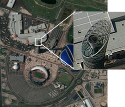
Information collected and processed by Bundesnachrichtendienst (BND) can be tailored for specific customer requests. By giving customers ready access to geospatial intelligence, the BND provides support to civilian and military leaders and contributes to the state of readiness of German military forces and close allies. The BND also contributes to peacekeeping and humanitarian efforts, such as tracking floods and disaster support. On request the BND can provide imagery tailored to the customer's needs. The release of military related imagery is done only to the closest allies of Germany, while peacekeeping and humanitarian related imagery is upon request for a broader group of nations and/or organizations.
